


甘肃炳灵丹霞国家地质公园
Gansu Bingling Danxia National Geopark
发布时间: 2020-06-29 10:55:50
Add Time: 2020-06-29 10:55:50
地理位置
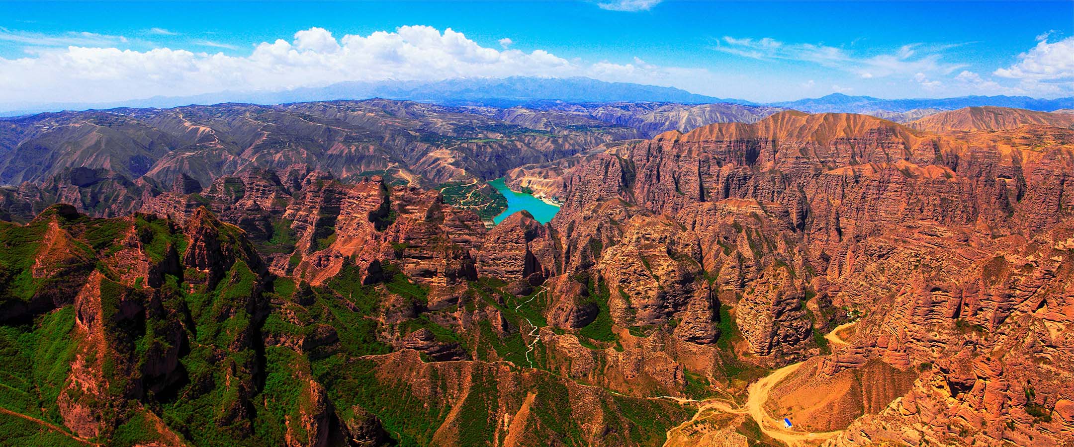
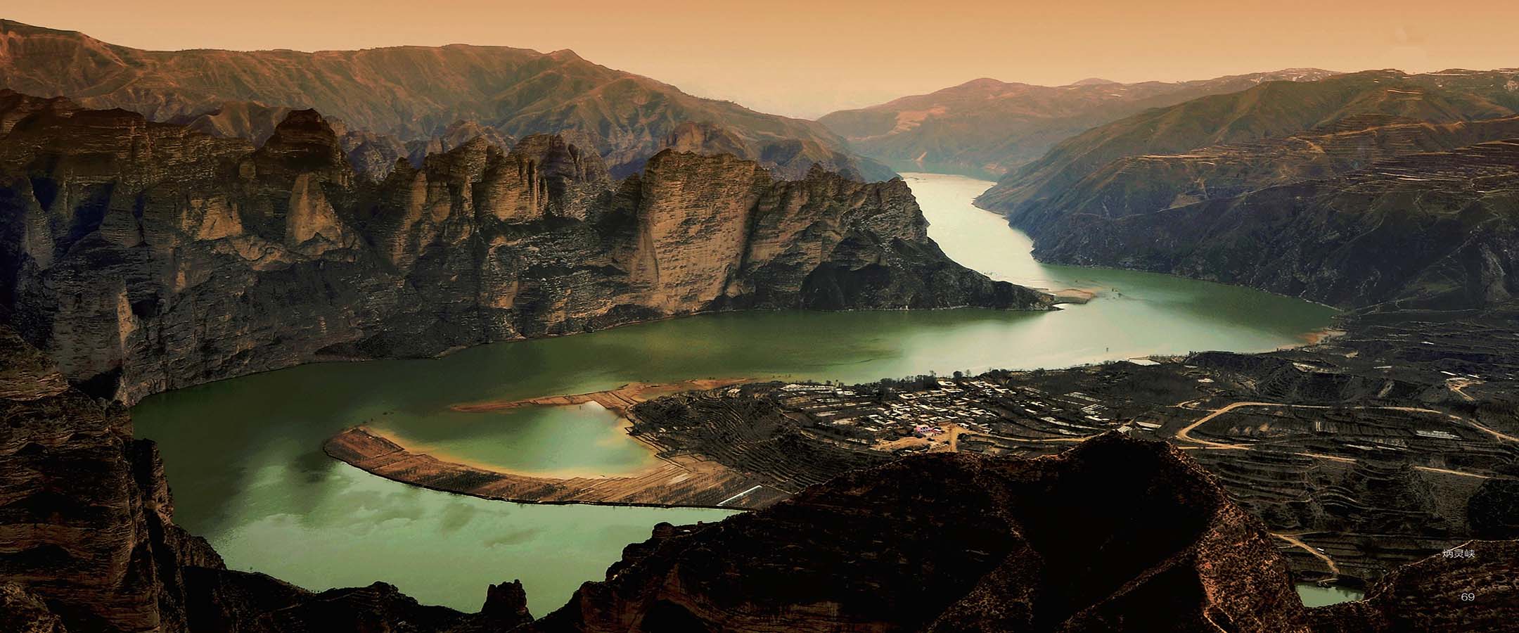
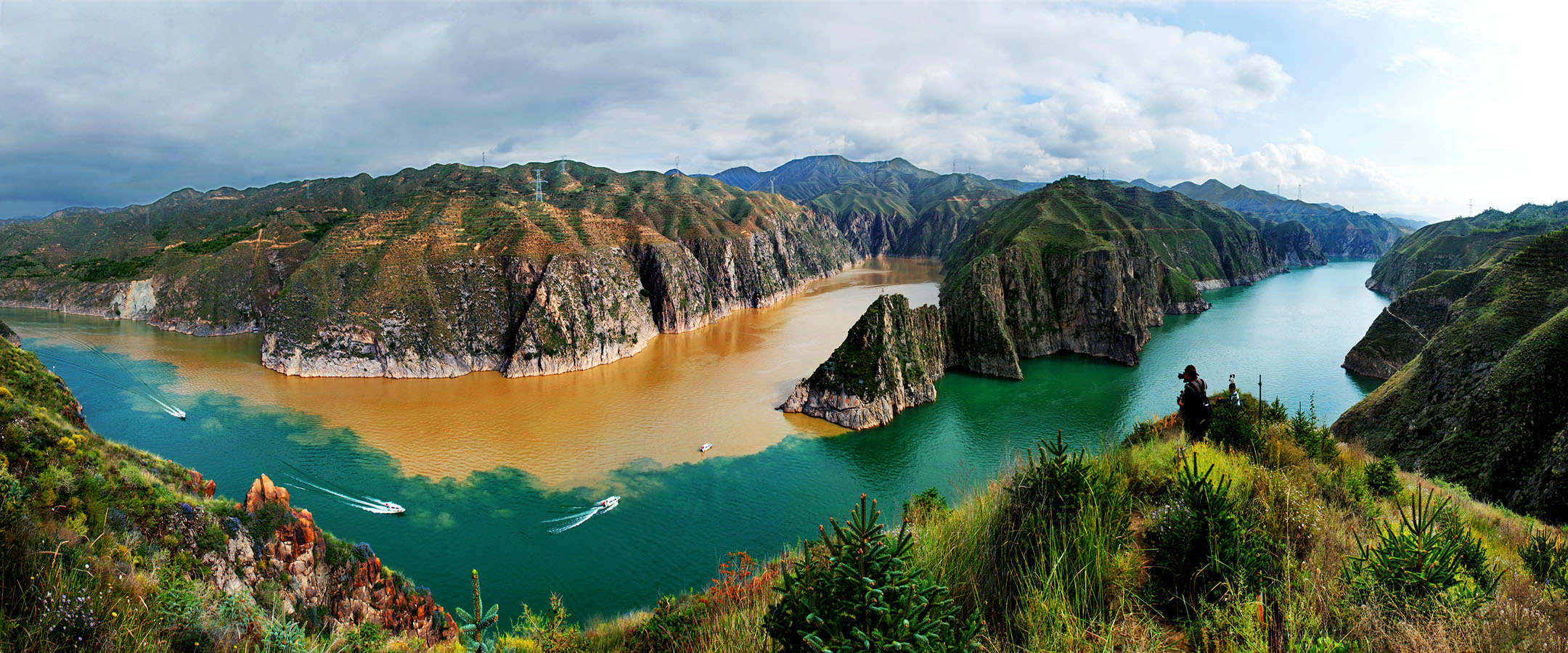
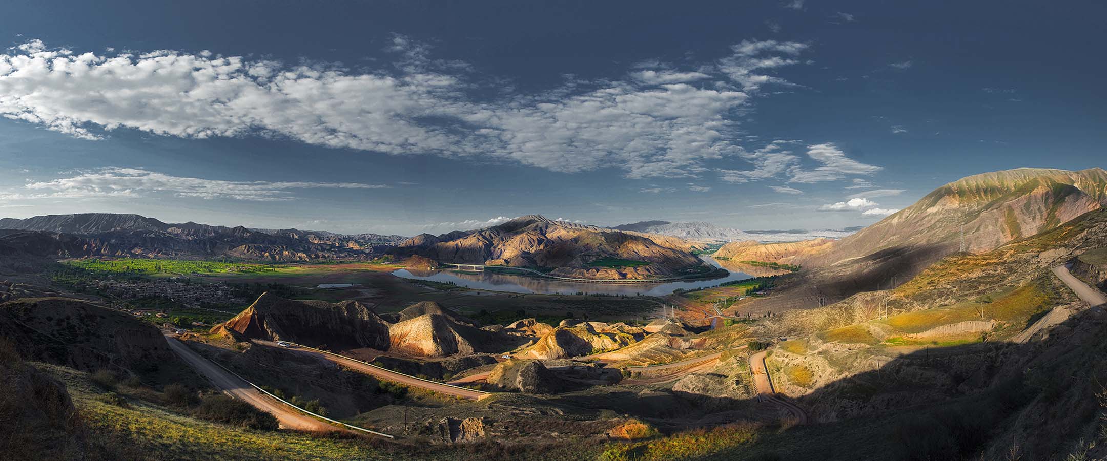
甘肃炳灵丹霞国家地质公园位于永靖县西南部,距永靖县城30公里。地理坐标为东经103°02′-103°05′,北纬35°02′-35°50′。
地质地貌
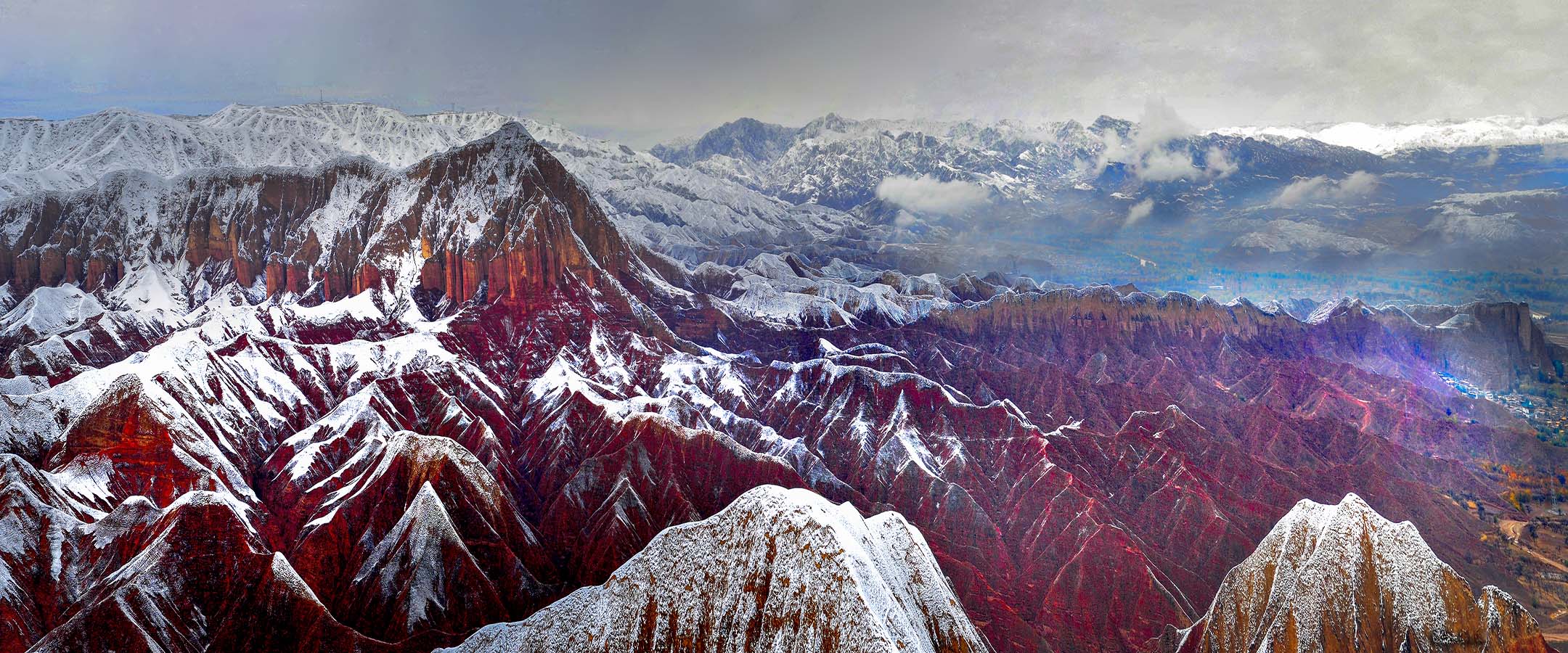
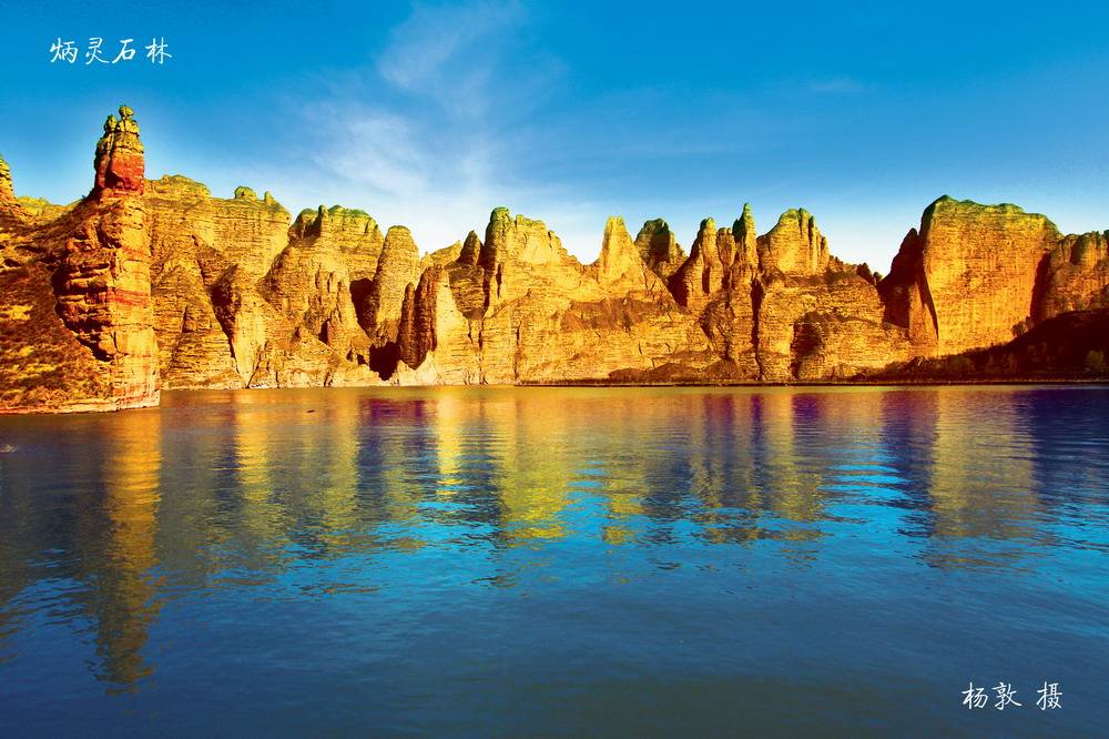
炳灵丹霞地貌主要发育于侏罗纪至第三纪的水平或缓倾的红色地层中,这种地貌以粤北地区韶关市内的丹霞山最为典型,所以称为丹霞地貌。丹霞地貌是红色砂岩经长期风化剥离和流水侵蚀而形成的孤立山峰和陡峭的奇岩怪石,是巨厚红色砂、砾岩层中沿垂直节理发育的各种丹霞奇峰的总称。
所谓“红层”是指在中生代侏罗纪至新生代第三纪形成的红色岩系,一般称为“红色砂砾岩”。丹霞地貌发育始于第三纪晚期的喜马拉雅运动。这次运动使部分红色地层发生倾斜和舒缓褶曲,并使红色盆地抬升,形成外流区。流水向盆地中部低洼处集中,沿岩层垂直节理进行侵蚀,形成两壁直立的深沟,称为巷谷。巷谷崖麓的崩积物在流水不能全部搬走时,形成坡度较缓的崩积锥。随着沟壁的崩塌后退,崩积锥不断向上增长,覆盖基岩面的范围也不断扩大,崩积锥下部基岩形成一个和崩积锥倾斜方向一致的缓坡。崖面的崩塌后退还使山顶面范围逐渐缩小,形成堡状残峰、石墙或石柱等地貌。随着进一步的侵蚀,残峰、石墙和石柱也将消失,形成缓坡丘陵。
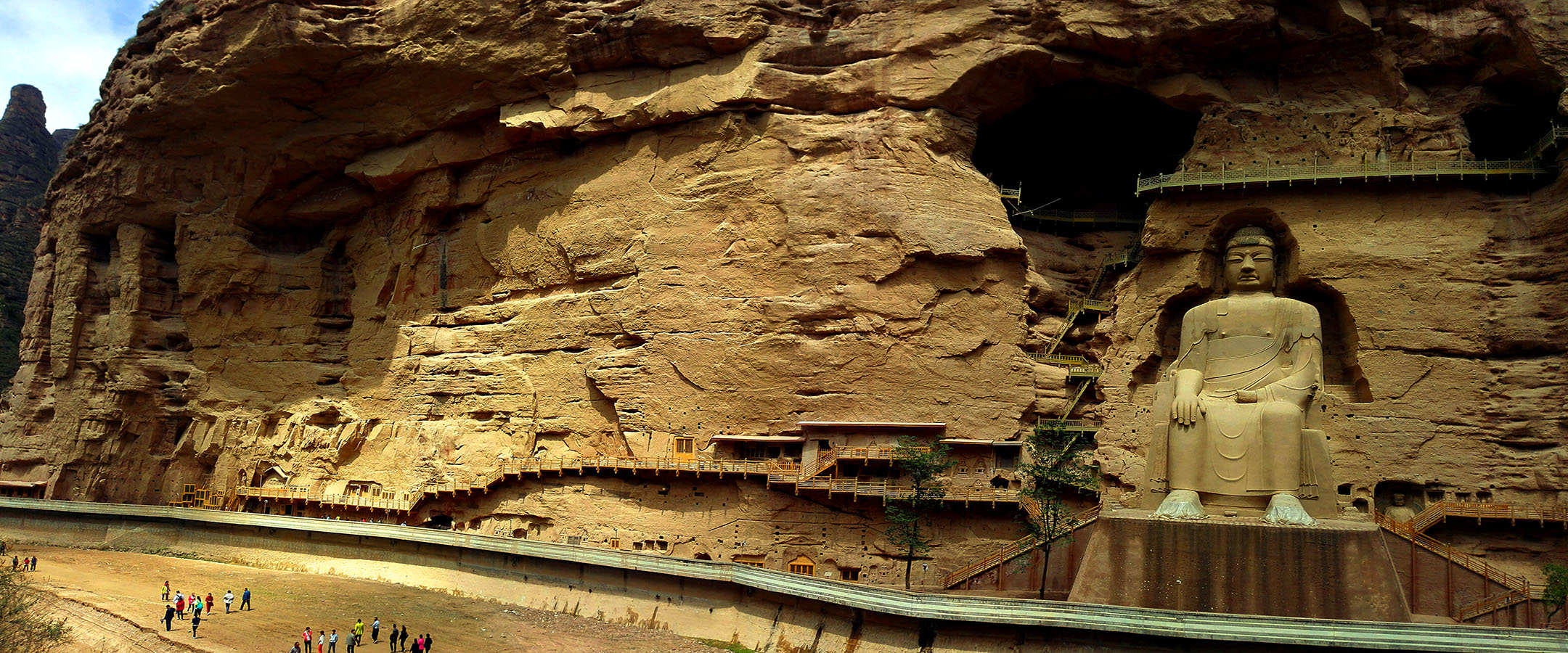
在红色砂砾岩层中有不少石灰岩砾石和碳酸钙胶结物,碳酸钙被水溶解后常形成一些溶沟、石芽和溶洞,或者形成薄层的钙化沉积,甚至发育有石钟乳。沿节理交汇处还发育漏斗。
在砂岩中,因有交错层理所形成锦绣般的地形,称为锦石。河流深切的岩层,可形成顶部平齐、四壁陡峭的方山,或被切割成各种各样的奇峰,有直立的,堡垒状的、宝塔状的等。在岩层倾角较大的地区,则侵蚀形成起伏如龙的单斜山脊;多个单斜山脊相邻,称为单斜峰群。岩层沿垂直节理发生大面积崩塌,则形成高大、壮观的陡崖坡;陡崖坡沿某组主要节理的走向发育,形成高大的石墙;石墙的蚀穿形成石窗;石窗进一步扩大,变成石桥。各岩块之间常形成狭陡的巷谷,其岩壁因红色而名为“赤壁”,壁上常发育有沿层面的岩洞。丹霞地貌最突出的物点是“赤石壁丹崖”广泛发育,形成了顶平、身陡、麓缓的方山、石墙、石峰、石柱等奇险的地貌形态,各异的山石形成一种观赏价值很高的风景地貌,是名副其实的“红石公园”。
geographical position
Gansu Bingling Danxia National Geopark is located in the southwest of Yongjing County, 30 kilometers away from Yongjing county. The geographical coordinates are 103 ° 02 ′ - 103 ° 05 ′ E and 35 ° 02 ′ - 35 ° 50 ′ n.
Geology and geomorphology
Bingling Danxia landform is mainly developed in the Jurassic to tertiary level or gently dipping red stratum. This landform is most typical of Danxia Mountain in Shaoguan City, northern Guangdong Province, so it is called Danxia landform. Danxia landform is an isolated peak and steep strange rock formed by long-term weathering and water erosion of red sandstone. It is the general name of all kinds of Danxia peaks developed along vertical joints in the thick red sand and conglomerate layers.
The so-called "red bed" refers to the red rock series formed from the Jurassic to the tertiary of the Cenozoic, generally known as "red glutenite". The development of Danxia landform began from Himalayan movement in the late Tertiary. This movement made some red strata incline and ease fold, and raised the red basin, forming outflow area. The flowing water concentrated in the low-lying areas in the middle of the basin, eroded along the vertical joints of the rock strata, forming a deep ditch with two vertical walls, which is called langu. When the water can not be moved away completely, the colluvium cone with gentle slope is formed. With the collapse and retreat of the trench wall, the colluvium cone is growing upward, and the coverage of the bedrock surface is also expanding. The bedrock under the colluvium cone forms a gentle slope with the same slope direction as the colluvium cone. After the collapse of the cliff, the scope of the top of the mountain is gradually reduced, and the landform of castle like residual peak, stone wall or stone pillar is formed. With further erosion, the remaining peaks, stone walls and stone columns will disappear, forming gentle hills.
There are many limestone gravels and calcium carbonate cements in the red glutenite. After the calcium carbonate is dissolved by water, it often forms some dissolution ditch, stone bud and karst cave, or forms thin layer of calcified deposit, and even develops stalactite. Funnel is also developed along the joint intersection.
In the sandstone, there are interlaced bedding to form a splendid landform, which is called Jinshi. The deep rock strata of the river can form square mountains with flat top and steep walls, or be cut into various strange peaks, such as upright, fortress and pagoda. In the area with a large dip angle, a monoclinic ridge with long undulations is formed by erosion; several monoclinic ridges are adjacent, which are called monoclinic peak groups. The rock stratum collapses along the vertical joints in a large area, forming a large and spectacular steep slope; the steep slope develops along the direction of a group of main joints, forming a large stone wall; the stone wall is eroded to form a stone window; the stone window is further expanded to become a stone bridge. Narrow and steep gullies are often formed between the rock blocks. The rock wall is called "Red Cliff" because of its red color, and there are often caves along the layer on the wall. The most prominent feature of Danxia landform is the wide development of "chishi cliff". It has formed the Fangshan, stone wall, stone peak and stone pillar with flat top, steep body and gentle foot. Different rocks form a kind of landscape with high ornamental value, which is worthy of the name of "Red Stone Park".
